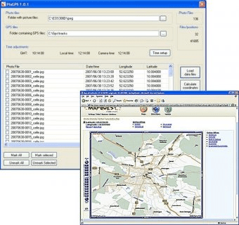
With PixGPS it's easy to track the exact positioin where you took your photos. You need a GPS Receiver. All you need to do is to have the GPS turned on when you ake the photos. After your photo session, download the photos from your camera and the track file from the GPS. PixGPS will calculate the position of each photo and insert this in the EXIF data of each photo. You can also see the location on a map or you can export a list of locations to Google Earth. It can also export positions to a text file so the data can be used with other software, such as mapping systems and databases.
Comments